(Editor's note: This story was first published and 2017 and updated in 2018.)
Stop No. 4 of the FLW Tour presented by General Tire hits Lake Cumberland at a time when winter seems to be finally breaking. Taking out of General Burnside Island State Park on the upper end, the pros have miles and miles of fishy water to dissect. The Tour stopped on Cumberland in 2017 and fished under dramatically different conditions – then the lake was low and clear, now the lake is about 3 feet over full pool and stained almost throughout.
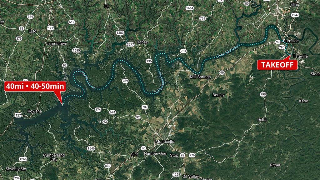
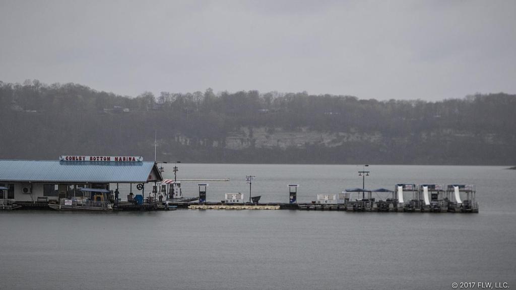
The sheer amount of water to cover in Cumberland is one of its defining features. Though there are fish to be caught up near takeoff, the lower end of the lake is historically where anglers find the best fishing, especially for smallmouth bass. Where exactly the lower end starts is a bit nebulous, but the area around Conley Bottom Marina or Wolf Creek and Caney Creek is a decent approximation. A little farther down the lake, Beaver Creek and Otter Creek could be considered the epicenter of the lower end. To get there is about a 40-mile run from takeoff and takes almost an hour in perfect conditions.

The biggest factor in travel times in Cumberland is floating debris. Though it’s a big enough lake that it can get rough, the waves rarely approach the size you can get on a place like Kentucky Lake. Instead, floating debris from rising water can clog the channel, forcing pros to idle for long stretches or risk severe boat damage. It’s not uncommon for water to come up quickly overnight on Cumberland, and if that happens, the pros will face very different conditions and greatly increased travel times. The two sections to watch out for the most are from the Highway 90 Bridge (known as the “iron bridge”) to Fishing Creek and from Conley Bottom Resort to Fall Creek. Conley Bottom is a pretty long way from takeoff, but the iron bridge and Fishing Creek are minutes from the ramp.

The lower end of the lake is known for smallmouths and clear water (which is currently fairly stained). Largemouths and spotted bass aren’t uncommon, but more than likely any pro venturing so far from takeoff will be looking for hefty bronzebacks. The lower end got a lot of pressure in 2017, and it figures to get just as much this year. One possible sweetener is the new limit in effect for this event. In 2017 smallmouths had to be at least 18 inches to keep – this year any bass over 12 inches is fair game.

The upper end of Cumberland is much more riverine, and it boasts high bluffs that resemble the James River arm of Table Rock. Like the lower end, it doesn’t have a whole lot of shallow water, but it does have consistently dirtier and warmer water. It also has more spotted bass and largemouths. In 2017, most of the action went down in the lower end, but enough pros cashed checks and made the cut from the upper end that it will surely be considered again this time around.

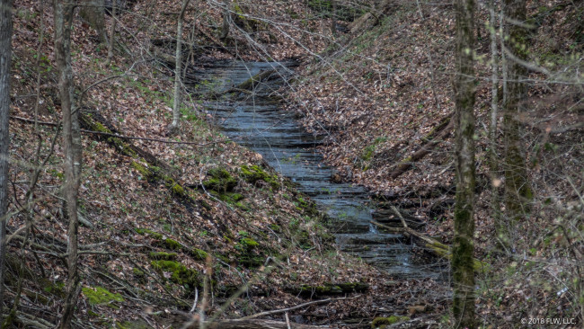
Up or down, one feature that anglers will no doubt keep in mind is inflowing water. From a creek or drain in the back of a short pocket to a waterfall tumbling off a bluff, inflowing water can be a real target. If it rains during the tournament, fresh running water can concentrate the bass. The influx of nutrients and edible critters is always welcome, and hungry bass and the anglers who follow them would do well to pay attention.

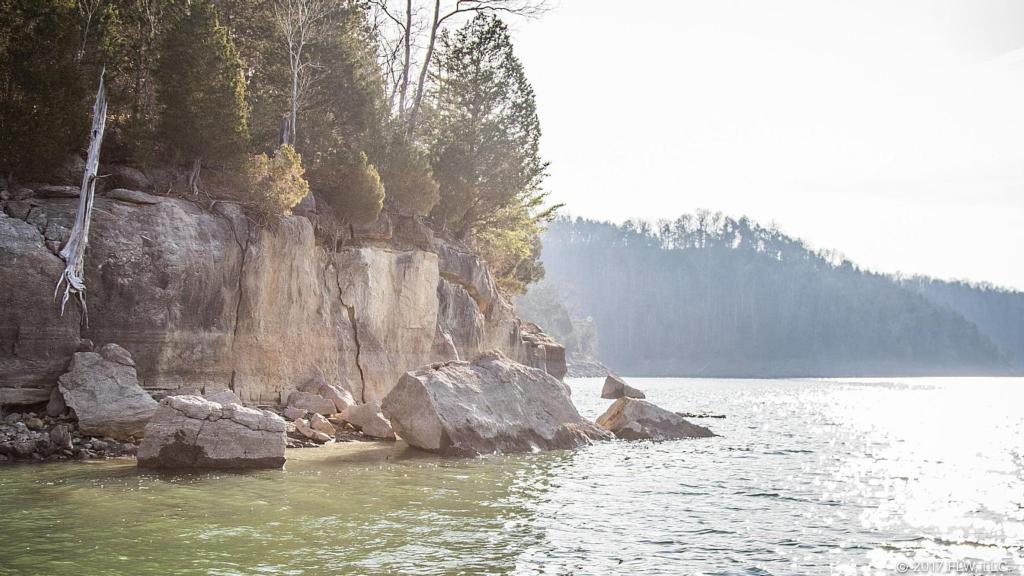
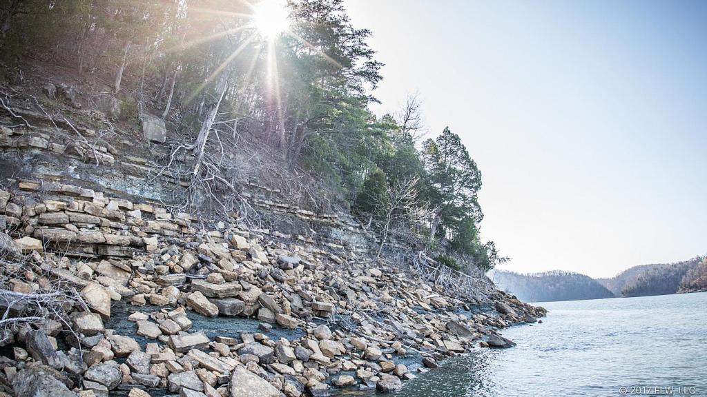
Once you get down to fishing, Cumberland doesn’t look that different from any other mountain reservoir. If you’ve ever been to Table Rock Lake, Beaver Lake, Norris Lake or Dale Hollow you’ll quickly recognize similarities. One of the primary types of cover is rock, but a lot of it is going to be submerged and hard to dial in on this week. With the water a few feet over the banks, it isn't nearly as easy to quickly distinguish what kind of rock you're dealing with.
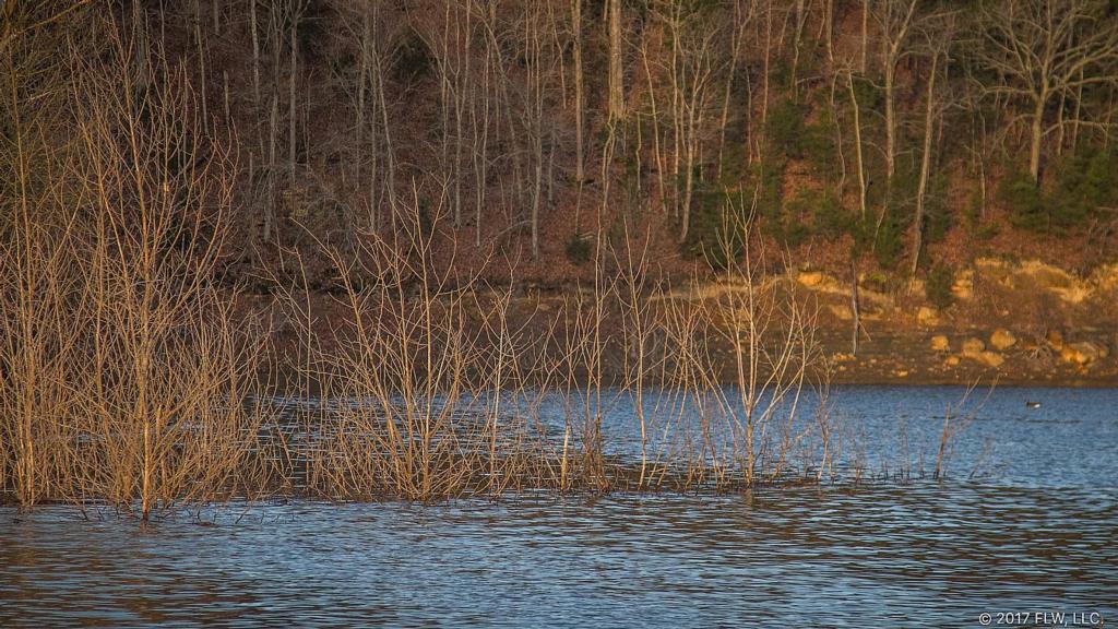


Cumberland was drawn down from 2007 to 2013 for dam repair, and that low water enabled many trees to grow up in what used to be open water. Some of the trees grew to more than 20 feet tall, and with the water back up they now provide a ton of cover for fish. In 2017 those trees made access to the banks difficult in the backs of pockets and were prime tagets. Though they still top out of the water in some cases, most of the trees are now submerged entirely and living trees are flooded up on the bank.

Cumberland sports a healthy mix of largemouths, smallmouths and spotted bass. As usual, the largemouths tend to live shallower and like to get around whatever cover they can (in many cases). Though Cumberland doesn’t have any grass, it does have mats made up of sawdust and debris or duckweed. It’d wouldn't be surprising to see someone get on a flipping pattern that centers around shade cover provided by these mats. Of course, there are also tons of flooded trees on the bank this year, so that could take some of the juice out of the sawdust pattern.
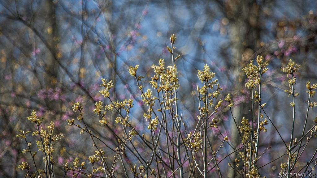
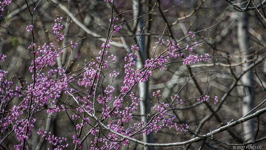
Despite a frigid practice, spring has sprung at Cumberland. The redbuds around the lake are beginning to pop, the water is warming into the mid-50s and the grass in the fields is greening up nicely. A few bass have undoubtedly started to spawn, but the makeup of Cumberland will make targeting bedding fish a little tricky this week. The lake is dirty enough that it’s going to be very difficult to see any on beds in most places, and the cold spring has many of the fish running a bit behind. Of course, that just means there will be more fat prespawn bass to go around.